Gemeinde Disentis
Description
Disentis is located in the district of Surselva in the Swiss canton of Graubünden.
The municipality has around 2200 inhabitants and covers an area of 91 square kilometres. The official language is Romontsch Sursilvan.
The following hamlets/fractions belong to the municipality: Mumpé Tujetsch, Segnas, Peisel, Buretsch, Cuoz, Acletta, Mumpé Medel, Funs, Clavaniev, Latis, Gonda, S. Gions, Dulezi, Raveras, Vitg, Cons, Sontget, Faltscharidas, Chischliun, Disla, Pardomat, Madernal, Cavardiras and Caprau.
Lowest point: 969 metres above sea level (Madernal)
Highest point: 3,614 metres above sea level (Péz Russein, Tödi)
Disentis is located in the district of Surselva in the Swiss canton of Graubünden.
The municipality has around 2200 inhabitants and covers an area of 91 square kilometres. The official language is Romontsch Sursilvan.
The following hamlets/fractions belong to the municipality: Mumpé Tujetsch, Segnas, Peisel, Buretsch, Cuoz, Acletta, Mumpé Medel, Funs, Clavaniev, Latis, Gonda, S. Gions, Dulezi, Raveras, Vitg, Cons, Sontget, Faltscharidas, Chischliun, Disla, Pardomat, Madernal, Cavardiras and Caprau.
Lowest point: 969 metres above sea level (Madernal)
Highest point: 3,614 metres above sea level (Péz Russein, Tödi)
Contact information
- La Pendenta
The longest suspension bridge in Graubünden – hiking path and scenic highlight in one.
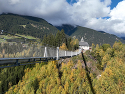
La Pendenta
The longest suspension bridge in Graubünden – hiking path and scenic highlight in one.
- Cascharia Clavaniev - Village Cheese Dairy Clavaniev
Old village cheese dairy of Clavaniev.
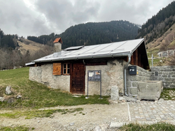
Cascharia Clavaniev - Village Cheese Dairy Clavaniev
Old village cheese dairy of Clavaniev.
- Disentis Local Bus
Local Bus Disentis
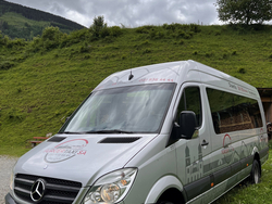
Disentis Local Bus
Local Bus Disentis
.png?fm=png&f=center&fit=fill&q=45&w=240)